


Boston
Color map in PDF format of downtown, showing sites of historic and cultural interest.
Boston Gas Company Photographs
Literally thousands of vintage photographs taken by commercial photographers contracted by the Boston Gas Company from the 1880s through the 1970s. Images document various construction projects and, in the process, capture candid portraits of life in Boston and its neighborhoods. From the John J. Burns Library collection at Boston College.
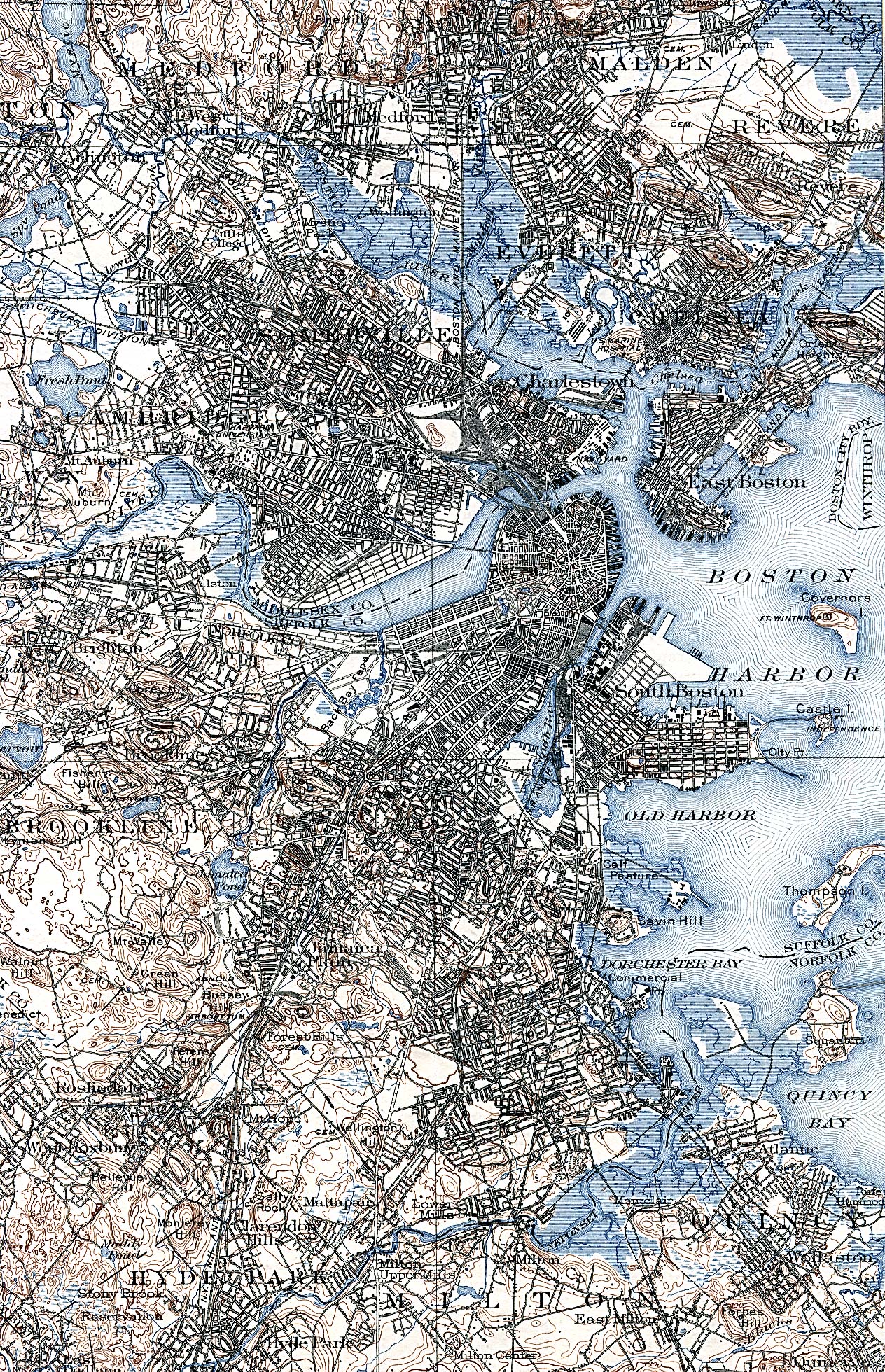
Boston in 1903
Oversized (1264x1960 pixels) map of the city and harbor, showing streets, neighborhoods, bodies of water and landmarks.
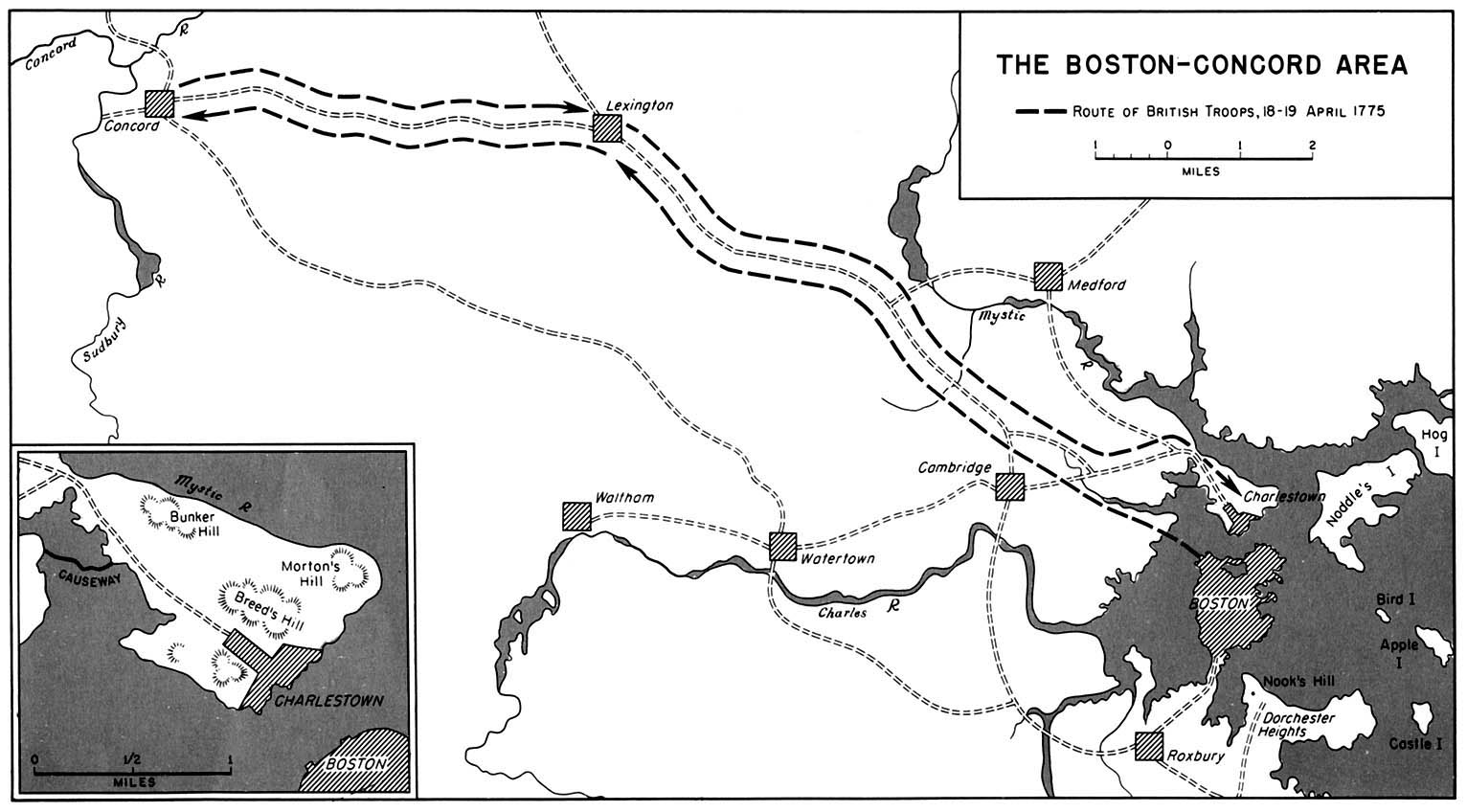
Boston-Concord
Oversized (1532x848 pixels) map showing route of British troops in April 1775.
Downtown Boston Route Map
Black and white reproduction of 1952 map from the American Automobile Association.
Picturesque Boston
Dozens of vintage photos of buildings, houses of worship, schools, monuments, statues and scenic views of Boston.
The Boston Gazette and Country Journal
Reproduction of front page, from October 7, 1776.
The History of Land Fill in Boston
Interactive map of how Boston grew from 1630 to 1890.