


Web Cams
Live Traffic Report I-8 At I-805, Mission Bay Beach Webcam, Panda Cam at the San Diego Zoo, View San Diego Bay
Balboa Park Map
A clickable map with 46 links to information about the park's facilities and monuments.
City of San Diego Neighborhoods Map
Map dividing the city into 8 areas, along with a list of the neighborhoods in each area. Links to each of the 8 areas provide more detailed maps. The result is that the locations of 100 neighborhoods are identified.
Directions to City Hall
Map showing downtown area near the City Administration Building, Civic Theater, and Golden Hall, along with parking facilities.
Downtown San Diego
Map shows streets, some major sites, and trolley lines.
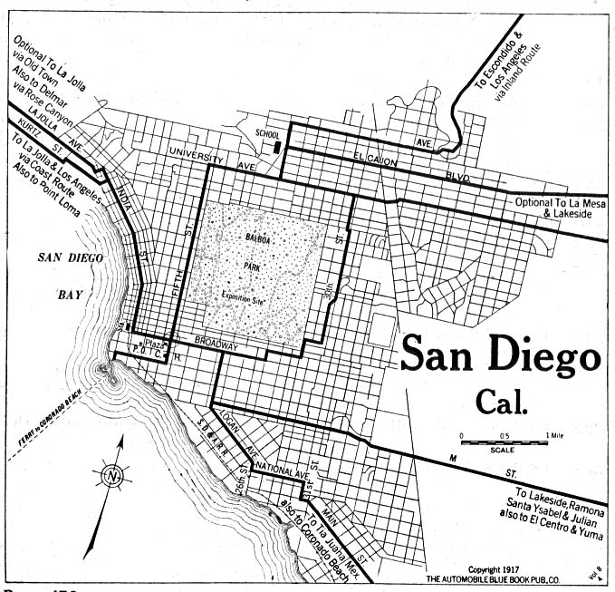
Historical map of San Diego in 1917
Shows area around downtown San Diego.
Panorama of Map Room at UCSD
View of the map room at University of California San Diego.
Points of Interest Map
Shows major roads and points of interest. Covers most of the city, but omits some northern and eastern areas. Provided by California Division of Tourism in pdf format.
San Diego City Council Districts
Maps shows rough boundaries of each of the 8 districts.
San Diego Historical Society Photos
Large collection of historical photographs from the society's archives.